
Imagine
A system for processing and analyzing aerial imagery, satellite imagery and advanced scans, enabling you to extract information and insights from the field for planning, monitoring and decision-making.
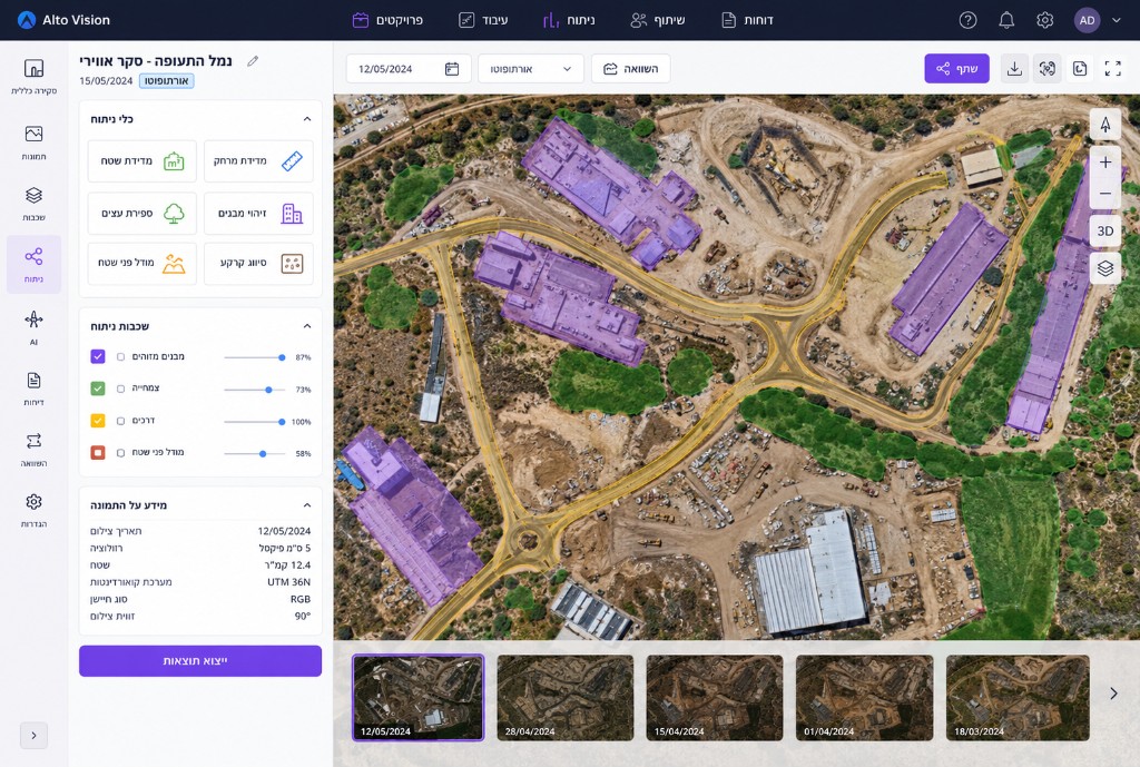
Aerial & satellite image processing and analysis
- Process aerial imagery, satellite imagery and advanced spatial data.
- Produce maps, orthophotos and accurate models of the field.
- Support a wide range of data sources and sensors.
Object & change detection
- Automatically detect objects, infrastructure and phenomena in space.
- Detect changes over time by comparing imagery.
- Extract insights from visual data for monitoring and control.
3D analysis & LiDAR data
- Process point clouds and LiDAR data.
- Create 3D models of terrain, buildings and infrastructure.
- Perform topographic analysis and understand terrain characteristics.
Processing automation
- Build automated processing workflows for large data volumes.
- Run complex processing chains without manual intervention.
- Reduce processing time and increase organizational throughput.
Working with diverse data sources
- Support aerial imagery, satellite imagery, LiDAR, drones and additional sources.
- Work in various formats without complex conversions.
- Combine data from multiple sources for unified analysis.
Performance at large scale
- Process large volumes of geographic data and imagery.
- Leverage advanced computing resources to accelerate analysis.
- Support large-scale projects and big datasets.
Frequently Asked Questions
How does the system help extract information from imagery, satellite and LiDAR sources?
Imagine streamlines and shortens the workflows for processing, correcting and orthorectifying satellite imagery, aerial imagery and UAV (drone) imagery, while improving the productivity and accuracy of the resulting data. It supports a wide range of sensor models, reduces errors through advanced matching and calibration mechanisms, and produces dense, high-quality point clouds using advanced technologies.
What types of data can be connected to the system?
Imagine supports a wide range of geospatial data sources: aerial and satellite imagery, radar data, vector data and point clouds. Support for diverse data types enables advanced processing and analysis, including high-accuracy orthophoto creation, to produce reliable and precise spatial information.
Interested in this product?
Fill out the form below and our team will get back to you shortly.