
Smart City Digital Twin
Local authorities deal daily with hazards, faults, infrastructure defects and resident complaints, but in most cases the information arrives only after the problem has already occurred. The solution enables the authority to continuously monitor the public space, detect hazards in real time and act proactively before complaints are filed or damage is caused to residents and infrastructure.
The business story
-
1
The Business Challenge
Most local authorities currently operate in a reactive model. Hazards are detected through proactive field patrols, calls to the municipal hotline or resident reports. This approach creates several challenges:
- Long response times for handling hazards.
- High costs of surveys and field inspections.
- Difficulty in producing a complete, up-to-date picture of the public space.
- Decision-making based on partial information.
- Exposure to lawsuits over hazards that were not handled in time.
- Overload on the municipal service centers.
- The authority sought to create an automatic, continuous monitoring mechanism that would provide an up-to-date picture of the city and enable a shift from reactive to proactive management.
-
2
The Solution
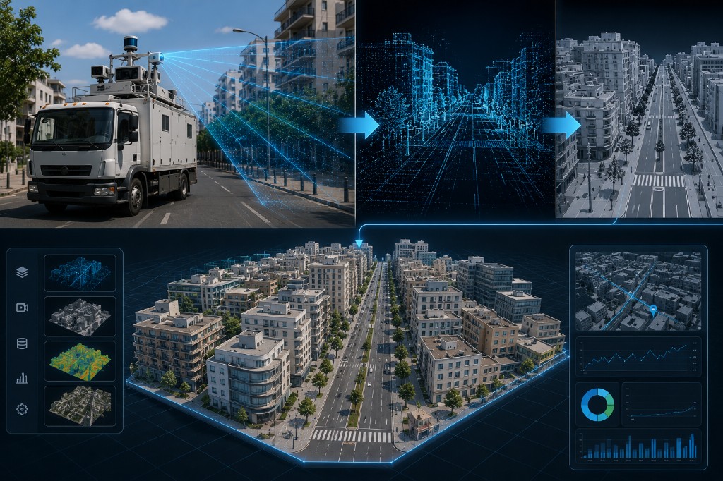
A smart-city solution based on a Digital Twin was developed for continuous scanning of the public space. The solution includes:
- Installation of smart cameras on a municipal vehicle fleet.
- Continuous collection of visual information from the public space.
- Automatic analysis of the data using hazard-detection algorithms.
- Detection of potholes, damaged sidewalks, faulty road signs, full bins and additional defects.
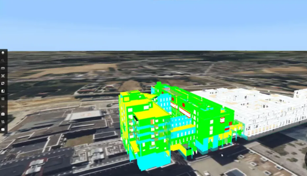
- Presentation of all information on a map interface and dashboards.
- Generation of real-time alerts to the relevant stakeholders.
- Production of reports and insights for decision-making.
- A built-in privacy-protection mechanism including face and license-plate blurring.
-
3
The Business Value
- Shifting from reactive to proactive management
The authority gains the ability to identify problems in the public space before they turn into complaints, safety hazards or events that require emergency handling. - Eliminating the need for dedicated surveys and field costs
Information is collected continuously as part of the municipality's routine activity, with no need for separate surveys for each area of activity. - A significant reduction in handling times
Automatic hazard detection enables information to be passed to the responsible party in real time and reduces handling times from days to hours or minutes. - Improved service to residents
Proactive, data-driven service enables faster handling of hazards and improves the service experience and quality of life in the public space. - Reducing exposure to risks and lawsuits
Continuous documentation of infrastructure condition and the ability to respond quickly to hazards help reduce exposure to liability claims and operational risks. - A cross-departmental municipal platform
The solution provides value to a wide range of municipal units — operations, engineering, sanitation, safety, parking, the municipal hotline and senior municipal management — from a single shared platform.
- Shifting from reactive to proactive management
-
4
Estimated deployment timeline
~4 Months to full deployment-
1
Proof of concept (POC, optional)
Capability proof and connection of initial data sources
~ 2 weeks -
2
Kick-off
Defining business goals and data sources
~ 1 week -
3
Characterization
Mapping needs, processes and the data model
~ 2-4 weeks -
4
Build & integration
Connecting systems, building the platform and dashboards, and testing
~ 2-3 months (depends on scope) -
5
Go-live
Training, onboarding and expanding usage
~ 1 week
-
1
-
5
Supporting products
Products implemented as part of this project
Want to hear more about this project?
Fill out the form below and our team will get back to you shortly.